Next Weather Alerts:
Friday
– Isolated showers, thunderstorms through the evening
– Stronger storms to the west
Saturday
– Windy, warm and muggy
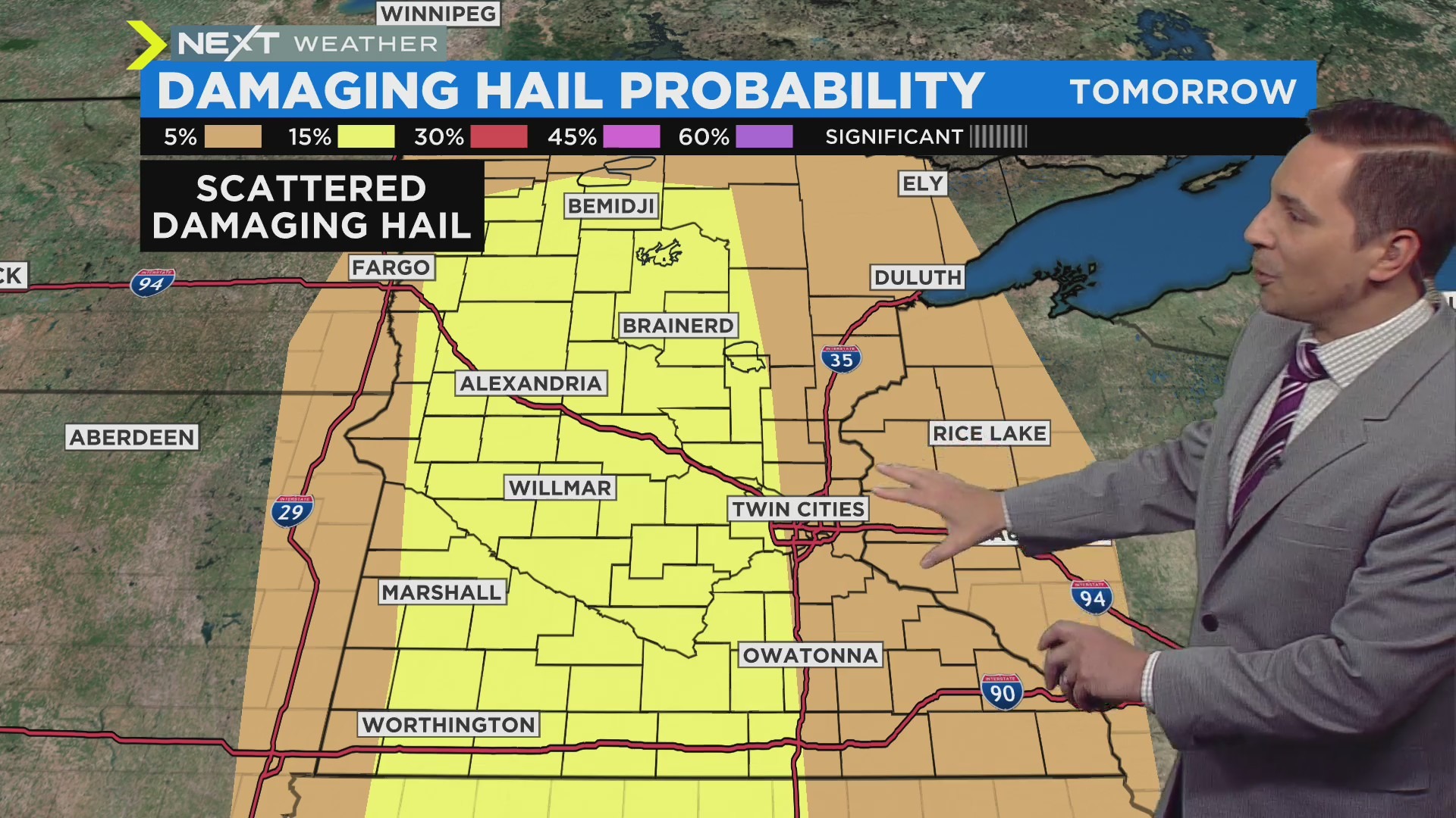
– A few damaging thunderstorms likely
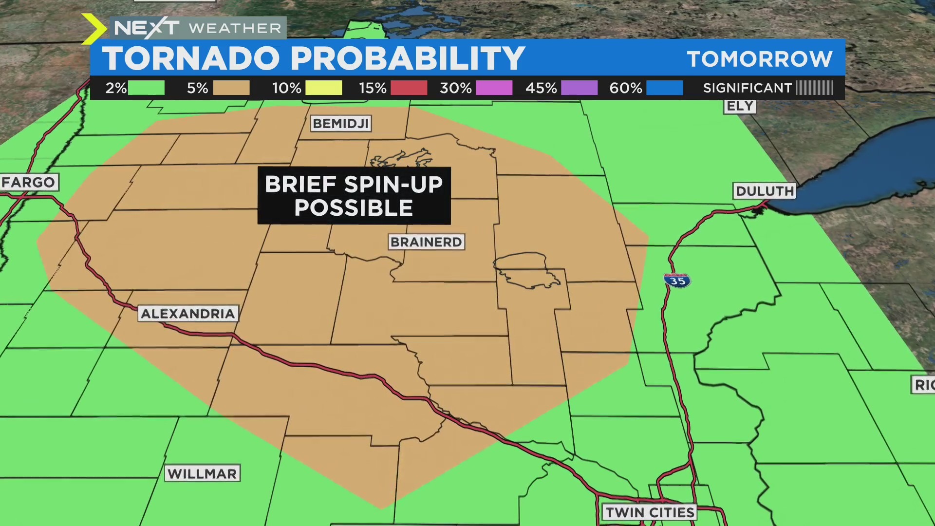
– Brief tornadoes possible in northern MN
MINNEAPOLIS (WCCO) — Scattered showers and isolated storms are likely Friday, and another system could bring damaging storms on Saturday.
RELATED: What Is Next Weather?
Friday morning was soggy, with some thunder in southern Minnesota. The Twin Cities area could see some showers off and on into the afternoon, and could potentially hear a clap of thunder.
While most of Minnesota and Wisconsin are seeing a marginal (1 out of 5) risk for severe weather, more-intense storms are expected in Nebraska and South Dakota. Those storms will be weakening as they move into western Minnesota after dark but a few could still produce some damaging hail or wind gusts, beginning around 10 p.m. Friday and continuing overnight into early Saturday morning.
High temperatures on Friday will reach the mid-50s.
SATURDAY OUTLOOK
Saturday will be much warmer. Highs will reach into the 70s, and it’ll be humid.
There will likely be some pop-up showers in the Twin Cities, but the risk for severe weather is in the evening. Around dinnertime, some isolated severe storms could make their way through the metro on south.
The biggest threat is damaging hail.
However, there is a possibility of tornadoes briefly spinning up in a large area of northern Minnesota, including cities like Bemidji, Brainerd and Alexandria.
Localized flooding is likely in northern Minnesota due to the rain and snowmelt.
Cooler weather arrives Sunday into next week, and the pattern stays fairly quiet.
Source: CBS Minnesota


Be First to Comment