MINNEAPOLIS (WCCO) — Thursday is another Next Weather Alert day as dangerous heat and another round of potentially severe storms threaten Minnesota.
MORE: Widespread Damage, Power Outages After Wednesday’s Severe Storms
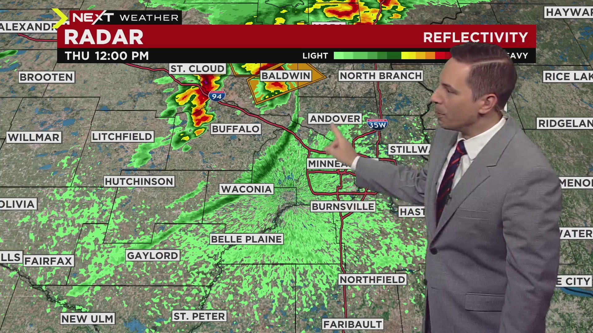
Some thunderstorms are moving through western and central Minnesota in the early afternoon. The system is pulling towards St. Cloud and Brainerd, just north of the Twin Cities and is dropping golf ball-sized hail.
Swaths of central and eastern Minnesota are under a severe thunderstorm watch through 5 p.m. The watch has been issued for Anoka, Chisago, Isanti, Kanabec, Pine, Ramsey, and Washington counties, as well as several counties in northwestern Wisconsin.
These severe storms have put out an outflow boundary; a line of rain-cooled air rushing towards the Twin Cities. As it passes by, it could bring a brief sprinkle and gusty winds, but could also produce more severe weather if it meets the edge of the warm front currently over southeastern Minnesota.
Credit: CBS
Next Weather Alert: Damaging Winds, Heavy Rain, Possible Tornadoes
A more active system is expected to arrive in the evening, especially after the dinner hours. Western Minnesota is facing a moderate risk of severe weather, and a large portion of Minnesota is seeing an enhanced risk. Northern Minnesota and southeastern Minnesota are at a slight risk.
Upgrade to MODERATE risk this evening across western MN. Wind damage, large hail, and a few tornadoes are still expected #MNwx @WCCO pic.twitter.com/MuYCisIqaq
— Riley O’Connor (@RileyOConnorwx) May 12, 2022
https://platform.twitter.com/widgets.js
Damaging winds and heavy rain will be the main concerns with this round of storms, though hail and even tornadoes are also possible.
Western Minnesota – from the northern to southern border – is under the greatest risk for tornadoes. The storms will head eastward in the evening hours, and the greatest risk for severe weather will be between 10 p.m. and 2 a.m. in the Twin Cities.
There is also the risk of severe flash flooding, as the ground is already primed from last night’s torrential rain. Over the past 24 hours, some areas in western Minnesota saw over 4.5 inches of rain, and will get hit again by downpours on Thursday night.
Temperatures will soar throughout the day Thursday, reaching nearly 90 in the Twin Cities. Dew points will also be high as there was a record amount of moisture in the air on Thursday morning, according to the National Weather Service.
MORE: Check out live radar right here.
After the threat passes, Friday will feature lower humidity and more sunshine. Temps will cool to the 70s through the weekend, and next week will start out in the 60s.
Source: CBS Minnesota


Be First to Comment