Stay Informed: WCCO Weather App | Live Radars | More
MINNEAPOLIS (WCCO) – A messy system is moving throughout the region, leaving behind a coating of ice in western Wisconsin, and threatening another round of rain and snow on Saturday afternoon throughout Minnesota.
A low-pressure system moved through overnight and in the early hours of Saturday, leaving behind slippery roads and a glazing of ice. The ice storm finished around 9 a.m.
Power outages were reported overnight; at it’s peak, around 10,000 customers were without power, but that number dwindled down to 3,500 by about 10 a.m.
Precipitation will return in the early afternoon, through temperatures from the Twin Cities on east will be warm enough for rain during the day. There is still a threat for severe thunderstorms between 1 p.m. and 8 p.m., but the tornado threat has decreased to a small sliver in southeastern Minnesota.
Here’s your #mnwx #wiwx forecast update, including what has stayed the same, and what has changed since last night. Overall, only slight adjustments.
What’s left in the Metro:
RAIN: about 0.50″
ICE: about 0.10″ (after dark)
SNOW: 1-3″ overnight
SEVERE: Not likely pic.twitter.com/pnCfGFUYBe
— Mike Augustyniak (@MikeAugustyniak) March 5, 2022
https://platform.twitter.com/widgets.js
The storm is tracking a little further south and east than it initially looked, which means there will be a higher potential for freezing rain in the late afternoon northwest of the metro. The Spooner, Wisconsin area – which was hit especially hard by the ice on Saturday morning – could see around one tenth of an inch to a quarter of an inch of ice again on Saturday evening.
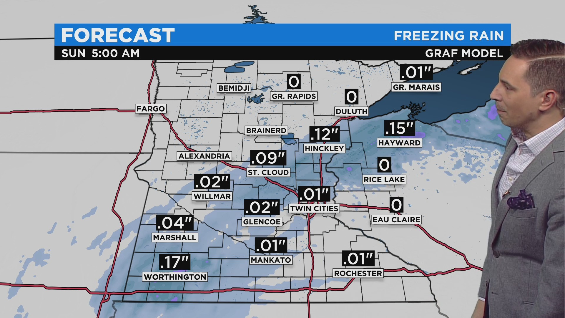
Credit: CBS
Then in the evening hours, the precipitation will transition into snow, which will hit the Twin Cities around 11 p.m. This means Sunday morning roads could be especially dangerous, with a thin layer of ice under the snow.
In all, WCCO Meteorologist Mike Augustyniak says around 1-3 inches of snow will fall in the metro, but more accumulation is expected in southwestern Minnesota, near Worthington. That area could see about 6 inches.
Temperatures on Sunday will top out around 30 degrees. Early next week will be a bit milder, but some plowable snow could hit on Thursday, bringing back the wintery temperatures.
Staying Safe
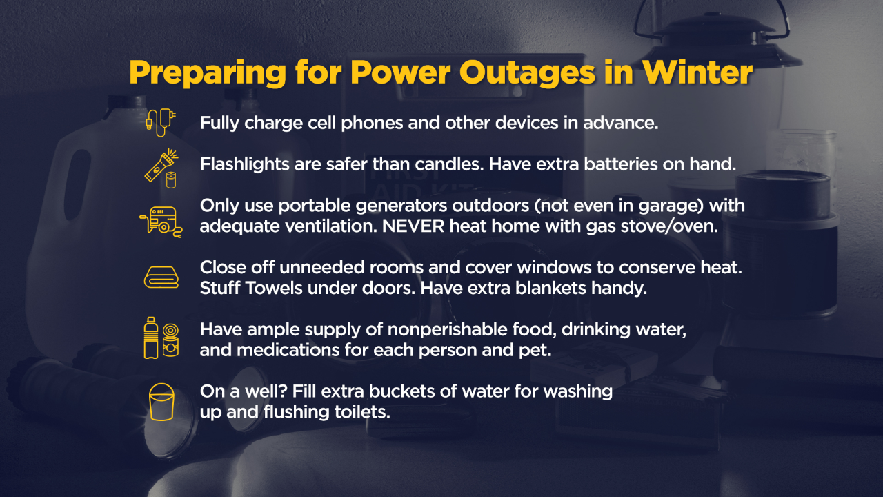
WCCO Meteorologists say travel is strongly discouraged on Saturday night and Sunday morning due to slippery roads. Those who must travel are encouraged to bring a flashlight, food, and water in case of an emergency. More ice could bring down power lines, causing outages once again.
Source: CBS Minnesota


Be First to Comment