MINNEAPOLIS (WCCO) – The first of a many waves of thunderstorms moved through the Twin Cities on Saturday morning, bringing widespread heavy rain for the first time in weeks.
Northern Minnesota missed out on the rain, but according to Meteorologist Mike Augustyniak, the rain will push slightly north with a warm front as the day goes on.
At WCCO in downtown Minneapolis 0.62″ of rain fell in 25 minutes — about 1/5th of ALL of the rain this summer (since June 1st).
This is also the largest single-storm rainfall since June 20th — almost 7 weeks ago.
More rain likely off and on through the weekend. #mnwx #mnwx pic.twitter.com/xDSroCd9CY— Mike Augustyniak (@MikeAugustyniak) August 7, 2021
https://platform.twitter.com/widgets.js
On Saturday evening, there is a slight threat of severe weather. Hail the size of ping pong balls and 60-70 mph winds are possible, and Augustyniak says he can’t rule out the chance of a tornado.
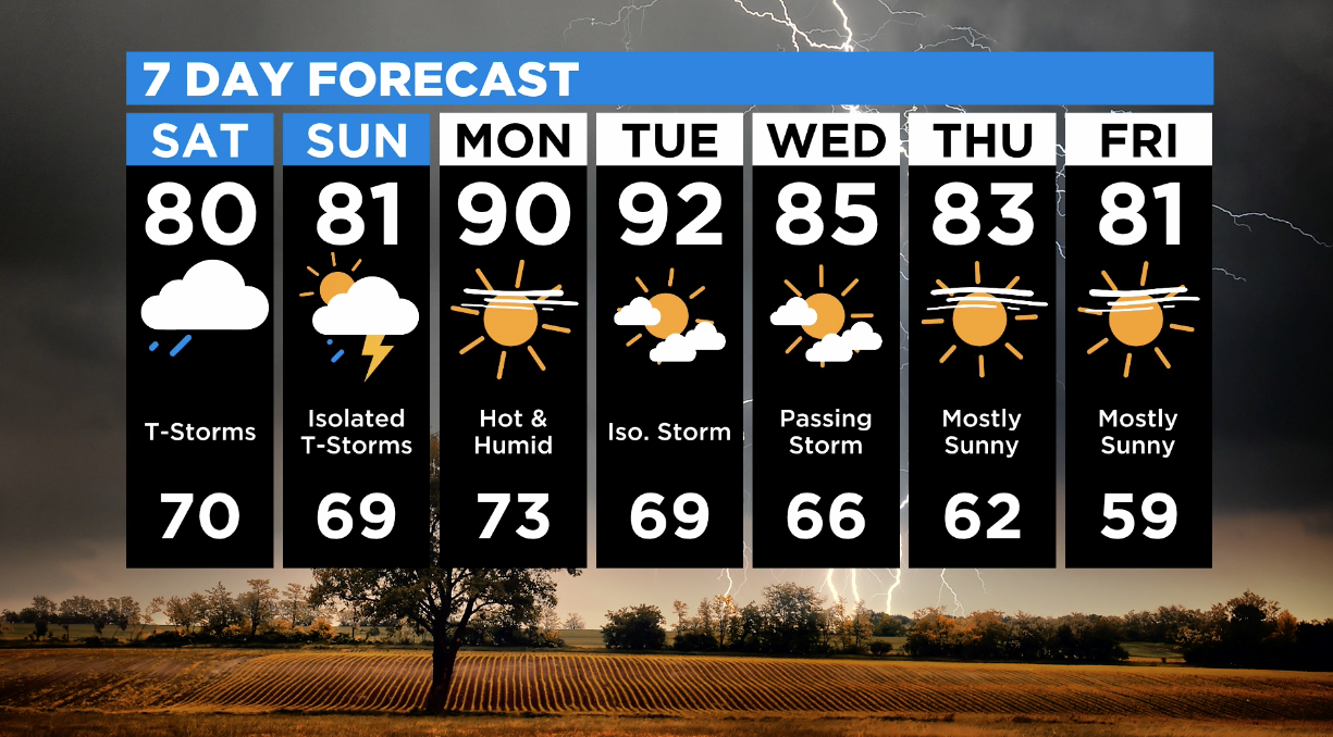
Until then, the rain will move east and weaken slightly. Temperatures will jump to near 80 degrees and it will be quite humid all day.
Sunday morning will see some rain and scattered thunderstorms on and off during the day, with some breaks of sun in between.
7 Day Forecast (Credit: CBS)
By Monday, the temperatures will be up to 90 degrees. Some isolated storms are possible on Tuesday and Wednesday, though most of the week looks to be dry.
Source: CBS Minnesota


Be First to Comment